Mineral projects must link exploration data, resource models and risk management in a transparent, quantitative way to support investment and operational decisions (Lindi et al., 2024; Rossi and Deutsch, 2013; McManus et al., 2021).
Conceptual Link: Exploration → Resources → Reserves
Exploration results feed geological models and block models, which underpin Mineral Resources and, after modifying factors, Ore Reserves and project value (Lindi et al., 2024). Uncertainty in geology, sampling and modeling can lead to 15% grade discrepancies, mine plan changes, production loss or even project failure (Lindi et al., 2024).
Case Study: Hypothetical Gold Deposit
Setting and Exploration Phases
- Vein‑hosted gold deposit; mining selectivity at 5 m × 5 m dig units.
- Two drill campaigns:
- Phase 1: sparse grid 100 × 100 m.
- Phase 2: dense infill to 25 × 25 m in core area.
- Assays composited to 1 m and 3 m intervals.
Four block‑model scenarios are compared, all using ordinary kriging supported by simulations:
- Sparse drilling, large blocks 50 × 50 × 10 m.
- Sparse drilling, small blocks 5 × 5 × 5 m.
- Dense drilling, large blocks.
- Dense drilling, small blocks.
Impact of Block Size, Drill Spacing, and Composites
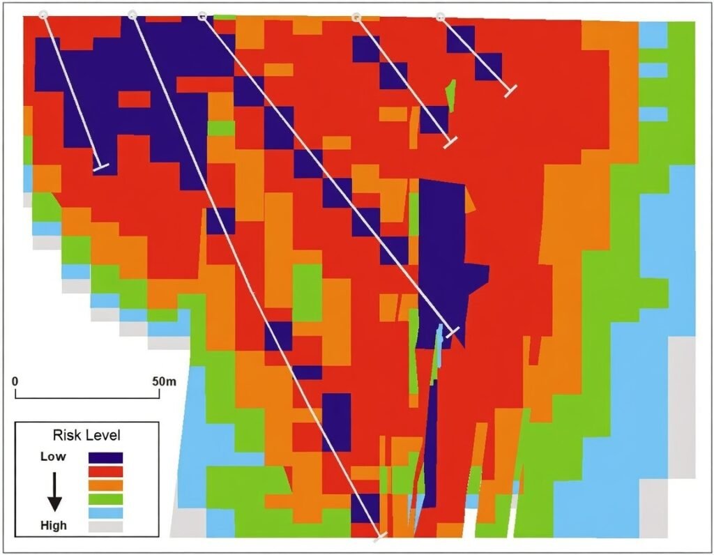
Evidence from real deposits shows that block dimension must be consistent with geology, mine method and drill spacing; large blocks are easier to estimate and their grades lie closer to true averages than small blocks (Lindi et al., 2024). Uncertainties arise from domain boundaries, search neighborhood and conditional bias and strongly affect precision at unsampled locations (Lindi et al., 2024).
Large vs small blocks
- Large blocks
- Lower relative error and closer to true mean grade with given data (Lindi et al., 2024).
- Strong smoothing; local highs and lows diluted, reducing short‑term mine planning fidelity (Rossi and Deutsch, 2013; , 2022).
- Small blocks
- Capture local variability and selectivity but, under sparse drilling, suffer strong conditional bias and unstable grades near data (Lindi et al., 2024; , 2022).
- Error and bias increase when block size is much smaller than drill spacing or variogram ranges (Lindi et al., 2024).
Dense vs sparse drill spacing
- Uncertainty in mineral resources decreases as drill spacing decreases; “optimal” spacing depends on acceptable uncertainty and deposit variability (Silva, Bassani and Costa, 2019).
- At 100 × 100 m, both large and small blocks show wide grade–tonnage envelopes; small blocks especially unreliable.
- At 25 × 25 m, uncertainties in tonnage and grade shrink significantly, allowing smaller blocks to be used credibly for planning (Lindi et al., 2024; Wang et al., 2020; Reis et al., 2021; Silva, Bassani and Costa, 2019).
Composite interval length and method
- Compositing to different lengths changes mean, variance and variogram structure; mishandling gaps/zeros further distorts statistics (Lindi et al., 2024).
- Short composites (1 m) preserve grade variance and extremes, making small blocks more sensitive to single intervals.
- Longer composites (3 m) smooth grades, simplifying variogram modeling but potentially understating short‑scale highs (Lindi et al., 2024; Rossi and Deutsch, 2013).
Classification and investment decisions
- Classification solely by spacing (e.g., number of holes per block) ignores geological domaining and spatial variability (Lindi et al., 2024; Owusu and Dagdelen, 2024).
- Geostatistical measures (kriging variance, conditional variance, block error, kriging efficiency, slope of regression) provide more objective, quantitative criteria for classification (Lindi et al., 2024; Taghvaeenezhad et al., 2020).
- At CMDIC Collahuasi, a stochastic framework updates simulations after each drilling campaign to quantify uncertainty and define drilling requirements based on explicit risk‑acceptance policies and budget constraints (Cáceres et al., 2025).
Design Choices and Estimation Accuracy
| Design choice | Main effect on estimation accuracy |
|---|---|
| Large blocks (given data) | Lower relative error; smoother grades; less local selectivity |
| Small blocks, sparse drilling | High local error and conditional bias; unstable grades |
| Small blocks, dense drilling | Better selectivity; still sensitive to variogram & domaining |
| Short composites | Preserve variance; increase small‑block sensitivity |
| Long composites | Reduce variance; easier modeling but less local fidelity |
| Wide drill spacing | High local/global uncertainty; broad grade–tonnage ranges |
| Tight drill spacing | Reduced uncertainty; supports smaller blocks, higher‑confidence classes |
Figure 1: Design parameters and their impact on estimation uncertainty
Expanded Risk Management Theory with Likelihood–Severity Scores
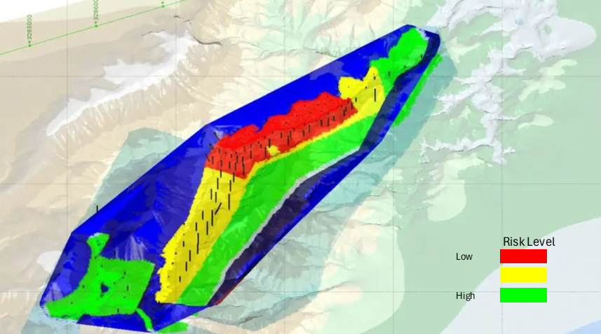
Risk can be structured into four categories; for each, a qualitative likelihood and severity score is suggested on a 1–5 scale (1 = very low, 5 = very high), consistent with semi‑quantitative risk matrices used in mining (Semenova and Sokolov, 2025; Nevskaya et al., 2024).
Geological Risk
Key elements:
- Conceptual geological model uncertainty; multiple plausible structural/stratigraphic models (Reid and Cowan, 2023; McManus et al., 2021).
- Domain and mineralization‑envelope uncertainty, especially in early stages (Lindi et al., 2024; McManus et al., 2021).
- Spatial heterogeneity and short continuity ranges (Lindi et al., 2024; Silva, Bassani and Costa, 2019).
Evidence: Downgrades and poor outcomes are often linked to weak structural and domain modeling (Reid and Cowan, 2023; McManus et al., 2021).
Risk scores (typical exploration–pre‑feasibility project)
- Likelihood: 4/5 (geological uncertainty is intrinsic and common).
- Severity: 4–5/5 (major impact on tonnage/grade and feasibility).
Sampling and Data‑Quality Risk
Components:
- Non‑representative samples, nugget effects, density errors (Lindi et al., 2024; Reis et al., 2021).
- Assay and logging errors; database issues (Lindi et al., 2024).
- Compositing and support choices that distort distributions (Lindi et al., 2024).
Evidence: 15% grade discrepancies from sampling/estimation errors can severely affect economics and cause production loss (Lindi et al., 2024); ignoring density variability changes LOM by 5% and NPV by ~2% (Reis et al., 2021).
Risk scores
- Likelihood: 3–4/5 (depends on QA/QC maturity).
- Severity: 3–4/5 (systematic biases propagate to resources and cash flow).
Modeling Risk
Components:
- Geological domaining and structural interpretation (Lindi et al., 2024; Reid and Cowan, 2023; McManus et al., 2021).
- Variogram, block size, search neighborhood, declustering, top‑cuts (Lindi et al., 2024; Rossi and Deutsch, 2013; Coombes, Tran and Earl, 2020).
- Over‑smoothed kriged models; conditional bias in small blocks (Lindi et al., 2024; Rossi and Deutsch, 2013; Chiquini and Deutsch, 2020; , 2022).
- Subjective classification choices and Competent Person judgement (Lindi et al., 2024; Owusu and Dagdelen, 2024; Taghvaeenezhad et al., 2020; McManus et al., 2021).
Evidence: Modeling and domaining are repeatedly identified as central drivers of resource uncertainty and downgrades (Lindi et al., 2024; Reid and Cowan, 2023; McManus et al., 2021); CP subjectivity leads to large differences in tonnage/grade from the same data (Owusu and Dagdelen, 2024).
Risk scores
- Likelihood: 4/5 (many subjective choices).
- Severity: 4/5 (changes classification, mine plan, and valuation).
Economic and Investment Risk
Components:
- Grade/tonnage uncertainty from geology and modeling (Lindi et al., 2024; Rossi and Deutsch, 2013; Taghvaeenezhad et al., 2020).
- Metal price and cost volatility; discount rates (Marković et al., 2025; Taghvaeenezhad et al., 2020; Matrokhina et al., 2023).
- Project‑specific factors (deep orebodies, low grades, high capex) (Marković et al., 2025; Taghvaeenezhad et al., 2020).
Evidence: For deep manganese ore, ore‑grade decline and price volatility dominate risk cost and can make projects uneconomic (Taghvaeenezhad et al., 2020). Stochastic planning shows wide NPV distributions with non‑trivial probability of loss (Marković et al., 2025).
Risk scores
- Likelihood: 3–4/5 (macro and microeconomic volatility common).
- Severity: 5/5 (direct effect on NPV/IRR and investment decisions).
Risk Score Summary
| Risk category | Typical likelihood (1–5) | Typical severity (1–5) |
|---|---|---|
| Geological | 4 | 4–5 |
| Sampling/data | 3–4 | 3–4 |
| Modeling | 4 | 4 |
| Economic | 3–4 | 5 |
Figure 2: Semi‑quantitative likelihood and severity scoring for key risk categories
Probabilistic and Geostatistical Tools in More Detail
1. Kriging and Block‑Model Uncertainty Metrics
- Ordinary kriging produces best linear unbiased estimates; block size, data count and search radii must reflect geology and mining method (Lindi et al., 2024; Rossi and Deutsch, 2013).
- Initial conditions for estimation—block size, sample counts and search ellipsoids—strongly influence unsampled‑location uncertainty (Lindi et al., 2024).
- Uncertainty metrics:
- Kriging variance (KV) and relative kriging variance.
- Kriging efficiency, block error, slope of regression (Lindi et al., 2024; Taghvaeenezhad et al., 2020).
These metrics can be translated into quantitative classification criteria (e.g., defining breakpoints in slope‑of‑regression distributions using fractal patterns for Measured/Indicated/Inferred) (Taghvaeenezhad et al., 2020).
2. Geostatistical Simulation
- Sequential Gaussian/indicator simulation (SGS/SIS) produces multiple equiprobable realizations, reproduces histograms and variograms, and eliminates kriging’s smoothing (Lindi et al., 2024; Chiquini and Deutsch, 2020; , 2022).
- Simulation yields:
- Global and local distributions of tonnage and grade.
- Probabilistic grade–tonnage curves and confidence intervals (Lindi et al., 2024; Chiquini and Deutsch, 2020).
- Recoverable resources incorporating mining selectivity and information effect (Chiquini and Deutsch, 2020).
Simulation allows drill‑spacing optimization and resource classification based on probabilistic criteria (e.g., thickness exceeding a threshold with given probability) (Wang et al., 2020; Huang et al., 2024).
3. Drill‑Hole Spacing Analysis (DHSA)
- Uses kriging and/or simulation to link drill spacing to relative estimation error for tonnage/grade or thickness (Lindi et al., 2024; Wang et al., 2020; Owusu and Dagdelen, 2024; Reis et al., 2021; Silva, Bassani and Costa, 2019).
- Case studies in bauxite and coal derive spacing thresholds for resource classes and optimal spacing for a chosen error level (Wang et al., 2020; Owusu and Dagdelen, 2024; Reis et al., 2021; Silva, Bassani and Costa, 2019).
- At CMDIC Collahuasi, stochastic modeling of each deterministic update provides uncertainty maps and optimized drilling campaigns consistent with risk‑acceptance criteria (Cáceres et al., 2025).
4. Quantitative Classification Frameworks
- Existing criteria: search neighborhood, KV, conditional variance, relative KV, projection pursuit transforms, and CP judgement (Lindi et al., 2024; Owusu and Dagdelen, 2024; Taghvaeenezhad et al., 2020).
- Quantitative frameworks estimate block‑model uncertainty and use distribution functions and fractal separation of KV/slope‑of‑regression populations to define objective cut‑offs for JORC classes (Taghvaeenezhad et al., 2020).
- This reduces CP subjectivity and improves comparability between projects (Owusu and Dagdelen, 2024; Taghvaeenezhad et al., 2020).
5. Geological‑Model Uncertainty Tools
- Outside‑in structural analysis using grade mid‑points and Maximum Intensity Projection constrains axial symmetry and plunge, reducing modeling degrees of freedom and eliminating structurally implausible configurations (Reid and Cowan, 2023).
- Domain‑model uncertainty assessment in early‑stage projects is crucial; methods include multiple alternative domain scenarios and quantitative uncertainty metrics for envelopes (McManus et al., 2021).
6. Prospectivity and Exploration Risk Tools
- Weights‑of‑evidence + economic modeling in GIS combine geological probability with economic parameters to compute an “exploration risk value” for targets; positive values indicate attractive risk–return (Partington, 2010).
- Monte Carlo‑based prospectivity mapping quantifies uncertainty in evidence layers (geology, geophysics, geochemistry) and propagates it via logistic regression, enabling risk–return analysis on prospectivity maps (Wang et al., 2020).
- Quantile regression forests predict full conditional grade distributions; targets at different risk levels are delineated using quantiles rather than only expected values (Huang et al., 2024).
7. Economic Risk and ISO 31000‑Based Models
- Hybrid deterministic–stochastic models integrate geological, technical and economic uncertainties in line with ISO 31000:2018 (Marković et al., 2025; Matrokhina et al., 2023).
- Monte Carlo simulation yields NPV distributions; risk indicators such as VaR and CVaR quantify downside risk and probability of project unprofitability (Marković et al., 2025).
- Scenario analysis, decision trees and interval‑probabilistic approaches help reduce information uncertainty in investment projects and support moderately pessimistic decision rules (Matrokhina et al., 2023).
8. Simulation Modeling for Operational Risk
- Production‑process simulation (e.g., for conveyor networks) can assess the impact of failures; one case showed 32.6% productivity loss from risk occurrences and demonstrated risk reduction through redesign (Nevskaya et al., 2024).
- These models complement geostatistical uncertainty tools by addressing technical/operational risks within the mine plan.
Integrating Scores and Tools into a Practical Workflow
A coherent exploration and resource‑estimation strategy would:
- Identify risks in the four categories and assign qualitative likelihood/severity scores early in the project.
- Design drilling, block sizes and composites together, using DHSA and simulations to quantify error vs spacing at the appropriate supports (Lindi et al., 2024; Wang et al., 2020; Reis et al., 2021; Silva, Bassani and Costa, 2019).
- Quantify geological and domain uncertainty, including structural analysis and alternative envelope scenarios (Lindi et al., 2024; Reid and Cowan, 2023; McManus et al., 2021).
- Estimate resources with kriging plus simulation, and compute block‑level KV/conditional variance and global grade–tonnage distributions (Lindi et al., 2024; Rossi and Deutsch, 2013; Chiquini and Deutsch, 2020; , 2022; Silva, Bassani and Costa, 2019).
- Classify resources quantitatively, combining uncertainty metrics and spacing with JORC‑style categories, minimizing CP subjectivity (Lindi et al., 2024; Owusu and Dagdelen, 2024; Taghvaeenezhad et al., 2020; Huang et al., 2024).
- Propagate uncertainty to economics via Monte Carlo/ISO 31000 frameworks and scenario analysis, linking geological risk scores to NPV risk measures (Lindi et al., 2024; Marković et al., 2025; Taghvaeenezhad et al., 2020; Matrokhina et al., 2023).
This integrated, risk‑scored framework ties exploration design, block‑model choices and probabilistic tools together, supporting defensible technical reporting and better‑informed investment decisions.
References
Cáceres, A., Emery, X., Ibarra, F., Pérez, J., Seguel, S., Fuster, G., Pérez, A., & Riquelme, R., 2025. A Stochastic Framework for Mineral Resource Uncertainty Quantification and Management at Compañía Minera Doña Inés de Collahuasi. Minerals. https://doi.org/10.3390/min15080855
Lindi, O., Aladejare, A., Ozoji, T., & Ranta, J., 2024. Uncertainty Quantification in Mineral Resource Estimation. Natural Resources Research, 33, pp. 2503 – 2526. https://doi.org/10.1007/s11053-024-10394-6
Wang, Z., Yin, Z., Caers, J., & Zuo, R., 2020. A Monte Carlo-based framework for risk-return analysis in mineral prospectivity mapping. Geoscience frontiers, 11, pp. 2297-2308. https://doi.org/10.1016/j.gsf.2020.02.010
Reid, R., & Cowan, E., 2023. Towards quantifying uncertainties in geological models for mineral resource estimation through outside-in deposit-scale structural geological analysis. Australian Journal of Earth Sciences, 70, pp. 990 – 1009. https://doi.org/10.1080/08120099.2023.2217882
Rossi, M., & Deutsch, C., 2013. Mineral Resource Estimation. Mineral Resource Estimation. https://doi.org/10.1007/978-1-4020-5717-5
Partington, G., 2010. Developing models using GIS to assess geological and economic risk: An example from VMS copper gold mineral exploration in Oman. Ore Geology Reviews, 38, pp. 197-207. https://doi.org/10.1016/j.oregeorev.2010.02.002
Owusu, S., & Dagdelen, K., 2024. Impact of Competent Persons’ judgements in Mineral Resources classification. Journal of the Southern African Institute of Mining and Metallurgy. https://doi.org/10.17159/2411-9717/1538/2024
Marković, P., Stevanović, D., Kolonja, B., Slavković, D., & Kržanović, D., 2025. A Hybrid Model for Risk-Based Strategic Planning in Open-Pit Mining: Integrating Deterministic, Stochastic, and ISO 31000 Approaches. Applied Sciences. https://doi.org/10.3390/app15052500
Taghvaeenezhad, M., Shayestehfar, M., Moarefvand, P., & Rezaei, A., 2020. Quantifying the criteria for classification of mineral resources and reserves through the estimation of block model uncertainty using geostatistical methods: a case study of Khoshoumi Uranium deposit in Yazd, Iran. Geosystem Engineering, 23, pp. 216 – 225. https://doi.org/10.1080/12269328.2020.1748524
Chiquini, A., & Deutsch, C., 2020. Mineral Resources Evaluation with Mining Selectivity and Information Effect. Mining, Metallurgy & Exploration, 37, pp. 965-979. https://doi.org/10.1007/s42461-020-00229-2
Huang, J., Wan, S., Mao, W., Deng, H., Chen, J., & Tang, W., 2024. Risk-Aware Quantitative Mineral Prospectivity Mapping with Quantile-based Regression Models. Natural Resources Research, 33, pp. 2433 – 2455. https://doi.org/10.1007/s11053-024-10403-8
Semenova, T., & Sokolov, I., 2025. Theoretical Substantiation of Risk Assessment Directions in the Development of Fields with Hard-to-Recover Hydrocarbon Reserves. Resources. https://doi.org/10.3390/resources14040064
Nevskaya, M., Shabalova, A., Kosovtseva, T., & Nikolaychuk, L., 2024. Applications of simulation modeling in mining project risk management: criteria, algorithm, evaluation. Journal of Infrastructure, Policy and Development. https://doi.org/10.24294/jipd.v8i8.5375
Matrokhina, K., Trofimets, V., Mazakov, E., Makhovikov, A., & Khaykin, M., 2023. Development of methodology for scenario analysis of investment projects of enterprises of the mineral resource complex. Journal of Mining Institute. https://doi.org/10.31897/pmi.2023.3
Coombes, J., Tran, T., & Earl, A., 2020. Going local – innovating resource estimates to improve investment decisions. Mineral Processing and Extractive Metallurgy, 129, pp. 1 – 11. https://doi.org/10.1080/25726641.2020.1725324
, 2022. XXI Conference of PhD Students and Young Scientists. Interdisciplinary topics in mining and geology. Book of Abstracts. **. https://doi.org/10.37190/xxi-cpsys-abstracts
Reis, C., Arroyo, C., Curi, A., & Zangrandi, M., 2021. Impact of bulk density estimation in mine planning. Mining Technology, 130, pp. 60 – 65. https://doi.org/10.1080/25726668.2021.1876481
McManus, S., Rahman, A., Coombes, J., & Horta, A., 2021. Uncertainty assessment of spatial domain models in early stage mining projects – A review. Ore Geology Reviews, 133, pp. 104098. https://doi.org/10.1016/j.oregeorev.2021.104098
Silva, C., Bassani, M., & Costa, J., 2019. Influence of drilling spacing on the mineral resources uncertainty. Mining Goes Digital. https://doi.org/10.1201/9780429320774-21

